
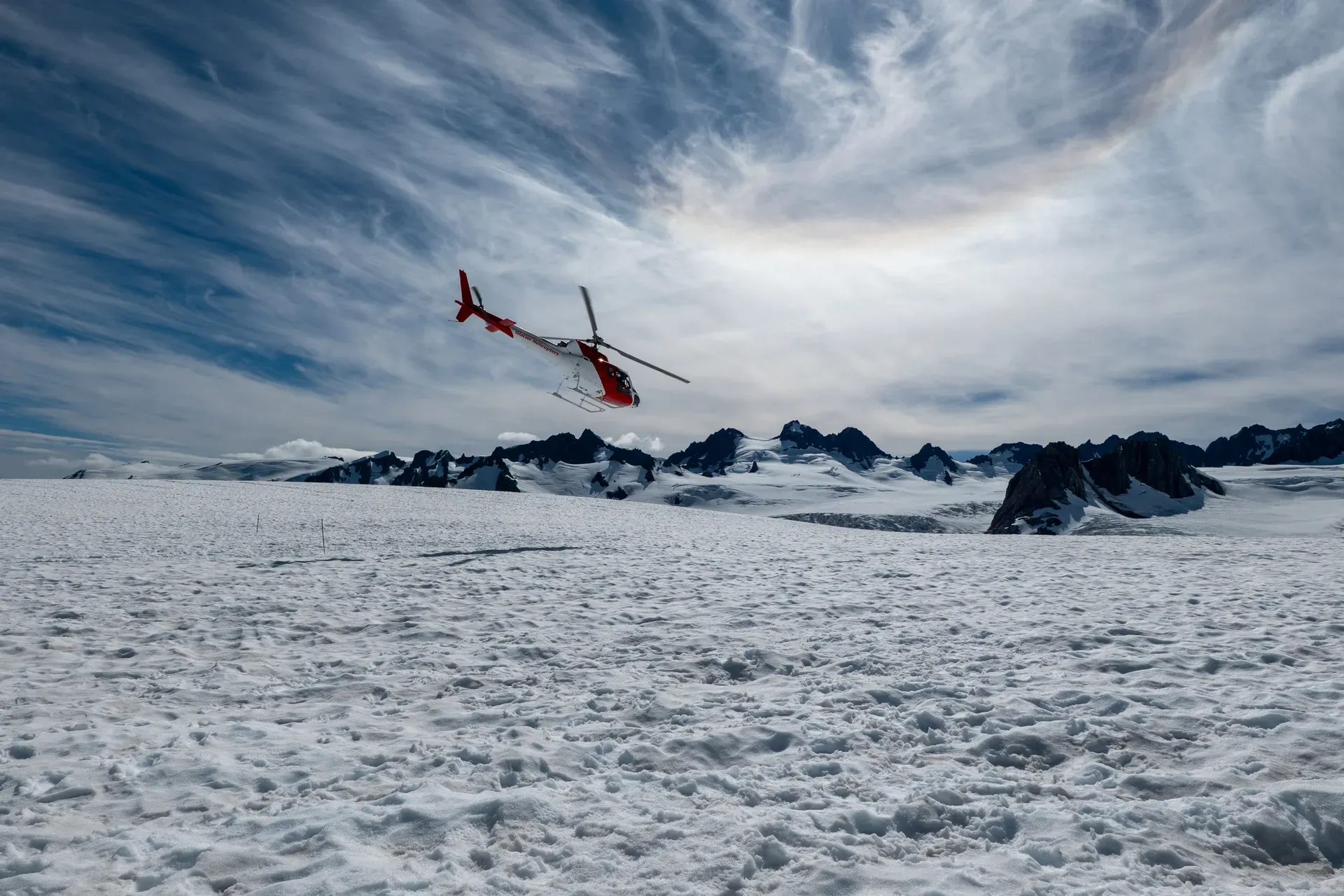
Fox Glacier is an 11.7-kilometer maritime glacier descending from New Zealand's Southern Alps into a temperate rainforest just 300 meters above sea level. It sits within the 2.6-million-hectare Te Wāhipounamu World Heritage Area on the South Island's West Coast.
Fox Glacier is an 11.7-kilometer temperate maritime glacier on the West Coast of New Zealand's South Island. It drops 2,600 meters from the Southern Alps down to a rainforest just 300 meters above sea level. Fed by four alpine glaciers, the ice mass covers roughly 32 square kilometers. Meltwater from the terminal face feeds the Fox River. The glacier sits inside Westland Tai Poutini National Park. This park forms part of Te Wāhipounamu, a 2.6-million-hectare UNESCO World Heritage Area inscribed in 1990.
Visitors access the valley via State Highway 6. The village sits 25 kilometers south of Franz Josef and 171 kilometers south of Hokitika. Most independent travelers self-drive or take a multi-leg coach journey. InterCity and GreatSights operate scheduled coach services from Queenstown to Fox Glacier village. The trip takes over seven hours and costs around NZ$130 to NZ$190. No direct bus exists from Christchurch. Travelers connect via Greymouth or Franz Josef on the South Island network. This makes it a full-day journey. Driving via State Highway 73 over Arthur's Pass takes about five and a half hours. Fill your fuel tank in Fox Glacier or Franz Josef before continuing your journey. There aren't any petrol stations between the two townships or between Franz Josef and Hokitika. Mobile phone coverage drops out frequently along the highway and entirely in the glacier valley.
The public South Side Walkway covers 6.4 kilometers return. It takes about two hours to walk. The gravel path winds through podocarp rainforest and crosses old glacial moraines. It ends at a viewpoint hundreds of meters from the ice. You can't walk directly to the terminal face on foot — a major storm destroyed the old access track. The terminal face is highly dangerous. Two Australian tourists were killed by a 100-tonne ice collapse in January 2009 after crossing safety barriers.
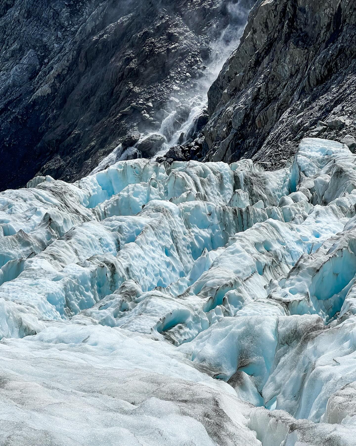
Helicopters provide the only direct access to the ice. Commercial operators run flights year-round. Guided heli-hikes land near Victoria Falls on the lower icefall. Guides cut steps through the crevasses and ice caves for up to three hours. Passengers wear provided leather boots and crampons. The trip costs NZ$795 per adult. The weather dictates the schedule. Spring brings the heaviest rain to the West Coast. Storms frequently ground flights and flood the valley tracks. Winter has the shortest daylight hours, but clear days offer excellent flying conditions. Summer and early autumn provide the most reliable weather. Book your helicopter trip for your first morning in town. That gives you time to reschedule when the clouds roll in.
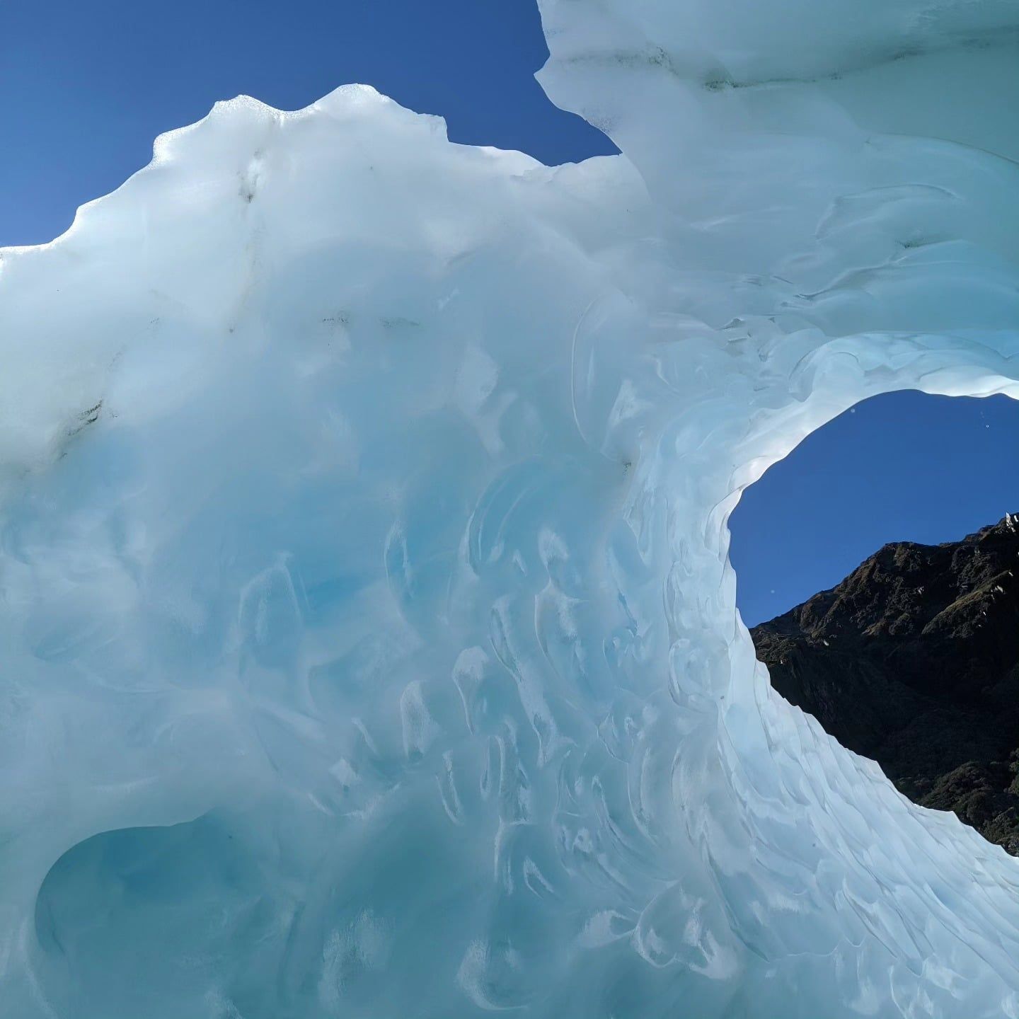
Local Māori guided Pākehā explorers Leonard Harper and Edwin Fox to the ice in 1857. They were the first Europeans to see the glacier. German geologist Julius von Haast surveyed the valley in 1865. He named the ice mass Albert Glacier. He paired it with the nearby Victoria Glacier. Premier Sir William Fox visited the West Coast in 1872. The lower section was renamed in his honor shortly after his trip.
Road crews built access routes up both sides of the valley in the 1930s and 1940s. These gravel tracks allowed tourists to drive close to the terminal face. The ice has moved constantly since those early surveys. It retreated steadily for a century. This withdrawal left behind infertile moraine ridges. Rainforest quickly recolonized these exposed terraces. You'll see this ecological succession clearly on the 4-kilometer Moraine Walk. The path branches off the main South Side Walkway. It shows exactly how plant life reclaims the barren rock over decades.
The glacier reversed course in 1985. It advanced 300 meters down the valley over the next 24 years. In 2006, the ice pushed forward at roughly a meter per week. The advance stopped abruptly in 2009. A high-water mark on the southern valley slope shows the exact peak of this surge. The glacier has retreated rapidly since that year. It has lost more than 3 kilometers of total length since the 1880s.
The New Zealand government passed the Ngāi Tahu Claims Settlement Act in 1998. This legislation officially changed the name to Fox Glacier / Te Moeka o Tuawe. The dual name recognizes the site's original human history. The physical landscape continues to change. Heavy rain and rockfalls frequently alter the valley floor. Glacial rivers can surge without warning if an ice dam bursts upstream. This floods the valley floor within minutes. Read the interpretive signs along the valley road for exact dates of the recent ice movements. Check the daily glacier access update on the official website before driving up the valley.
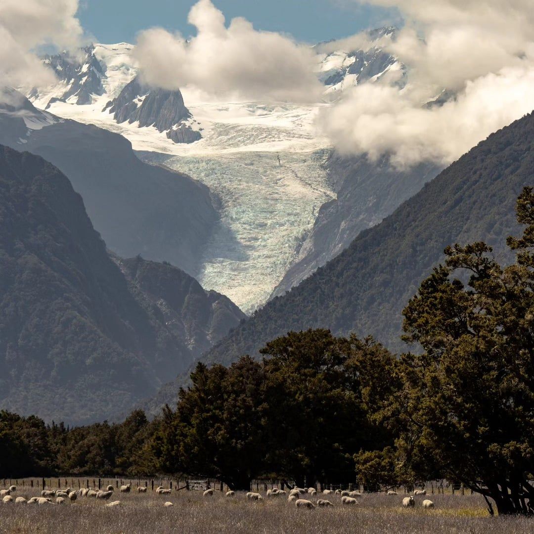
Fox Glacier rests on greywacke and schist bedrock of the Torlesse terrane. The catchment area covers 110 square kilometers. The Victoria Range bounds the ice to the north. The Fox Range borders the south. These mountains rise from sea level to 3,000-meter peaks within a 35-kilometer span. This steep gradient forces the ice down the valley at an unusually fast rate. Four separate alpine glaciers feed the main icefall. The massive accumulation of snow in the upper névé compresses into dense blue ice. This ice flows over steep bedrock drops. The movement fractures the surface into deep crevasses and towering seracs. The terminal face melts continuously at 300 meters above sea level. This runoff creates the freezing, fast-flowing Fox River.
The glacier's past movements shaped the surrounding landscape. A massive retreat thousands of years ago left a depression in the forest floor. Meltwater filled this kettle hole to form Lake Matheson. Tannins from the surrounding podocarp forest turn the lake water dark brown. This opaque surface acts as a clear mirror. On a calm day, it reflects Aoraki/Mount Cook and Mount Tasman. The lake sits 6 kilometers from the glacier village. A 4.4-kilometer loop track circles the water. The first section to Jetty Lookout is a flat, wheelchair-accessible gravel path. It takes 45 minutes return. The full loop takes an hour and a half.
Scenic helicopter flights offer an alternative for visitors who don't want to walk on the ice. These flights cost between NZ$350 and NZ$450. They circle over the upper icefall and névé without landing — passengers get aerial views of the full 13-kilometer glacier length and the surrounding Southern Alps. The helicopters depart from the village at fixed times, usually 8:50 am and 11:50 am, with extra flights added on demand. You can't bring drones, personal backpacks, or spare batteries on any commercial flight. Operators strictly enforce these rules. Flying an unauthorized drone in the valley can result in confiscation and a fine of up to $5,000.
Further down the highway, the Peak Viewpoint lookout sits 9 kilometers from the township toward the coast. It provides wide views over the glacier's upper snowfield and the Southern Alps. The Department of Conservation maintains these public viewpoints. Entry to the national park and all public walking tracks is free. Dogs are strictly prohibited on the valley tracks and the Lake Matheson Walk. Drones are illegal anywhere in the national park without a permit. Go to the 'View of Views' lookout at Lake Matheson at dawn for the clearest reflection. Midday winds usually ruffle the water and ruin the photograph.
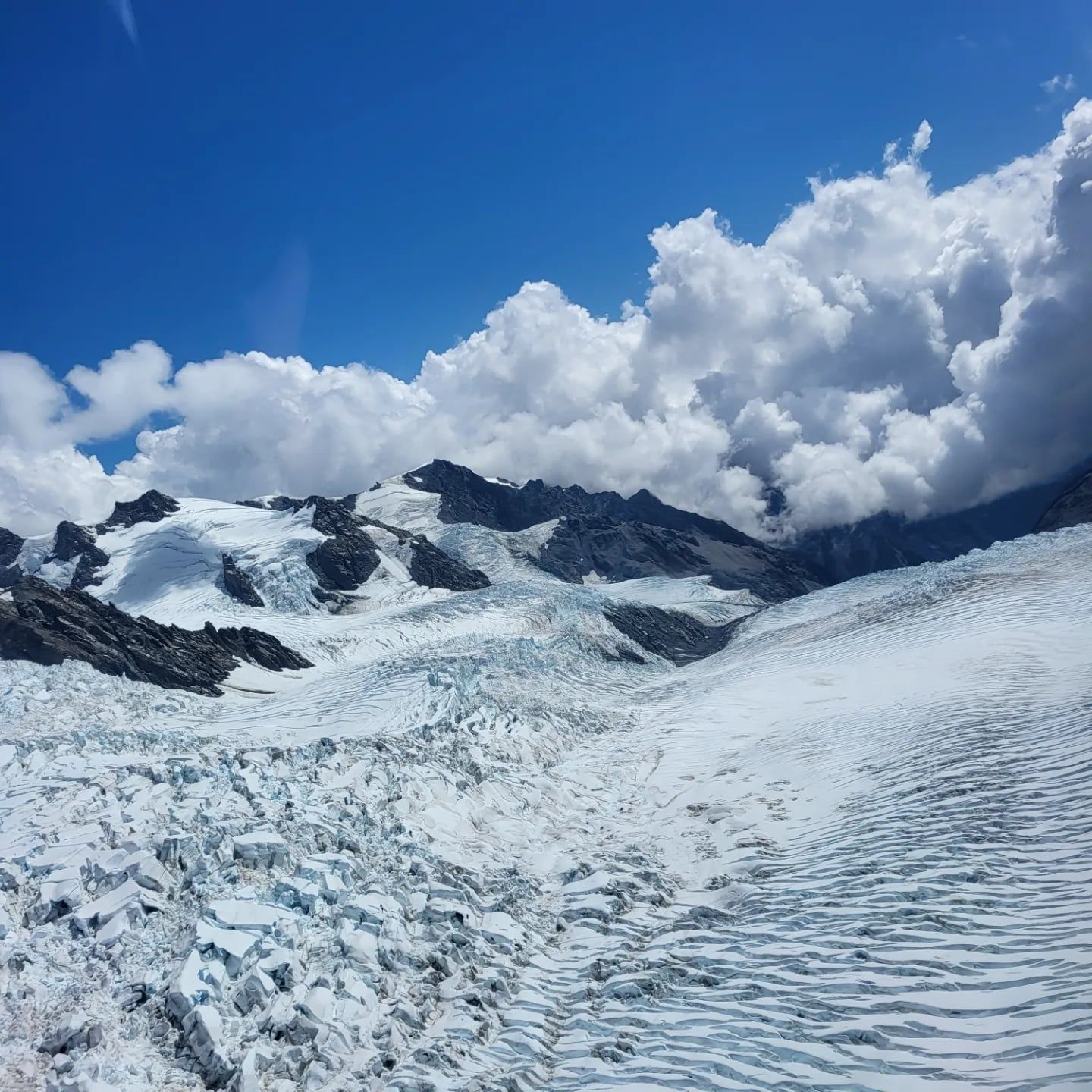
Fox Glacier holds cultural significance for Ngāi Tahu. The Māori name is Te Moeka o Tuawe. This translates directly to "the bed of Tuawe." Oral tradition states that the climber Tuawe died in an avalanche while exploring the Southern Alps. The glacier forms his final resting place. His partner, Hine Hukatere, grieved his death. Her tears froze to form the neighboring Franz Josef Glacier, known as Kā Roimata o Hine Hukatere. The two glaciers sit 25 kilometers apart — they are linked permanently by this history.
The surrounding environment provided specific resources for early Māori. The dark waters of Lake Matheson were a customary food-gathering site. Ngāi Tahu harvested long-finned eels (known as tuna in Māori) from the wetland. The lake remains an important habitat for these native fish. You'll spot them in the dark water from the boardwalk at the eastern end of the lake.
The cultural footprint extends beyond the immediate glacier valley. The Copland Track begins 26 kilometers south of Fox Glacier off State Highway 6. This multi-day tramping route leads to natural hot pools at Welcome Flat Hut beneath Aoraki/Mount Cook. It requires backcountry experience and careful planning. The West Coast highway connects these sites, running north to Hokitika. That town is a center for greenstone, or pounamu, carving. Pounamu holds high value in Māori culture. Travelers often stop at the carving workshops in Hokitika before driving two hours south to the glaciers.
Native birds populate the podocarp forest. Walkers frequently see tūī and kererū in the canopy. Kea (New Zealand's native alpine parrots) occasionally visit the valley. Feeding these birds alters their natural foraging behavior. The Department of Conservation actively discourages any interaction with wildlife. The visitor center in Franz Josef processes permits for specific activities within the park. It opens daily from 8:30 am to 5:00 pm. Tell someone your walking plans and expected return time before setting out on any of these tracks. The alpine weather changes rapidly. Temperatures on the ice can fluctuate between 0 and 25 degrees Celsius in a single day. Keep all food packed away when walking the tracks. Bring strong insect repellent. Sandflies swarm fiercely around Lake Matheson and the shaded rainforest sections of the valley.
The minimum age for commercial heli-hikes is 9 years old, and children must be accompanied by an adult.
Two tourists died in 2009 after crossing safety barriers and being crushed by a 100-tonne ice collapse.
Flying a drone anywhere in the national park without a permit carries a fine of up to $5,000.
The glacier advanced at a rate of roughly one meter per week during its 2006 surge.
The 4-kilometer Moraine Walk demonstrates how fast rainforest reclaims land left bare by retreating ice.
A lookout 9 kilometers toward the coast offers clear views of the upper snowfield.
The dark, still waters around Lake Matheson breed fierce sandflies year-round.
No. A major storm washed out the old access track. The public South Side Walkway now ends at a viewpoint hundreds of meters from the terminal face. The ice itself can only be reached on a guided heli-hike.
No. Entry to Westland Tai Poutini National Park and the public walking tracks is free. You only pay for commercial activities like guided walks, heli-hikes, or scenic flights.
Fox Glacier Guiding charges NZ$795 per adult and NZ$795 per child aged 9 to 16. These prices are valid until September 30, 2026. The trip includes about four hours total with up to three hours on the ice.
Fox Glacier village is 25 kilometers south of Franz Josef along State Highway 6. The drive takes about 25 to 30 minutes. This short distance makes it easy to visit both glaciers in one trip.
The glacier is highly sensitive to climate variability. It advanced 300 meters between 1985 and 2009, but entered a rapid retreat phase in 2008 that continues today. It has lost more than 3 kilometers of length since the 1880s.
The terminal face is highly dangerous due to falling ice and rockfall. Two tourists were killed by a 100-tonne ice collapse in January 2009 after crossing safety barriers. The Department of Conservation warns visitors to stay behind all marked barriers.
The glacier is known as Te Moeka o Tuawe, which translates to "the bed of Tuawe." According to local oral tradition, the climber Tuawe died in an avalanche, and the glacier marks his final resting place.
No. Flying a drone without a permit is illegal throughout Westland Tai Poutini National Park. Unauthorized drones can be confiscated, and operators warn of fines up to $5,000.
December to March offers the mildest weather and the best chance of clear helicopter flights. Spring is the wettest season on the West Coast, bringing a higher risk of track closures and flight cancellations.
The Fox Glacier South Side Walkway covers 6.4 kilometers return. It takes about two hours to walk. The path involves some uneven ground and an uphill climb near the end.
Browse verified tours with free cancellation and instant confirmation.
Find Tours