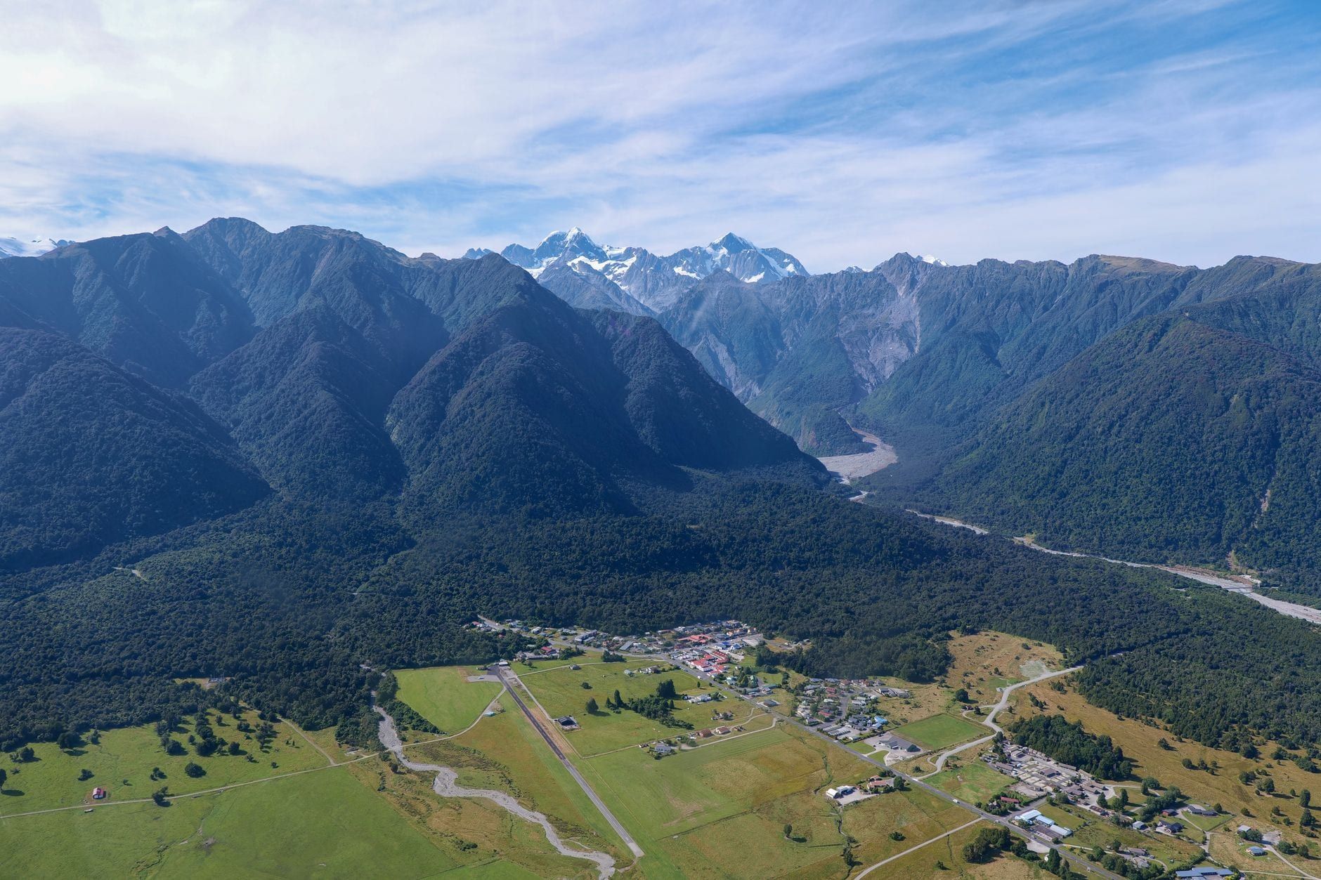
The Fox Glacier South Side Walkway is the track that gets you closest to Fox Glacier on foot these days — a 6.4 km return route through podocarp rainforest, ending at a viewpoint roughly 2,600 m from the ice. It's flat gravel for most of the way, DOC-maintained, and free to walk any day of the year.
Search this walk online and you'll find at least three different tracks half-answering the question, and it isn't obvious which one people mean. This guide sorts out which trail actually gets you there, what you'll see at each stage, and what can go wrong if you ignore the barriers near the end.
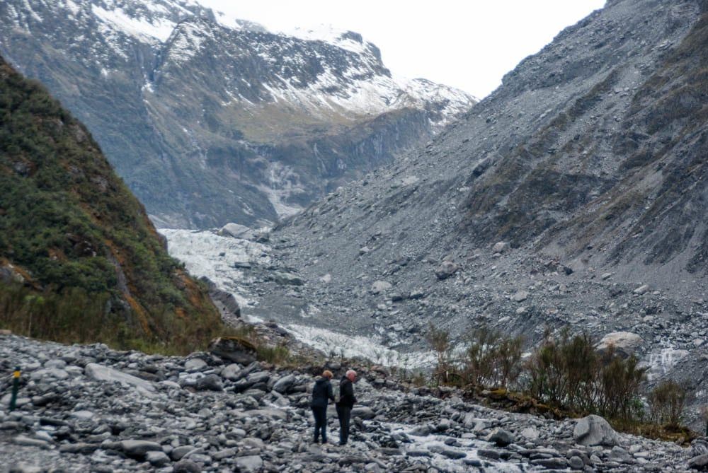
Fox Glacier South Side Walk at a Glance
Budget about two hours for the round trip on foot, or an hour if you're on a bike — DOC rates the walking as easy to intermediate and the cycling as Grade 2. The track climbs and drops roughly 100 m in total, nothing steep, just enough to notice by the end. There's no entry fee and no gate: it's open around the clock, all year, like every public track in the park. For the full picture on fees and access elsewhere in the area, see Fox Glacier opening hours and entry fees.
- 6.4 km return, about 2 hr walking or 1 hr cycling
- Elevation change of roughly ±100 m, easy-to-intermediate grade
- Free, open 24 hours a day, year-round, no permit needed
- Dogs are not allowed anywhere on the track
- No toilets at the car park — use those in Fox Glacier Weheka township first
Which Fox Glacier Track Is This? (Avoiding the Confusion)
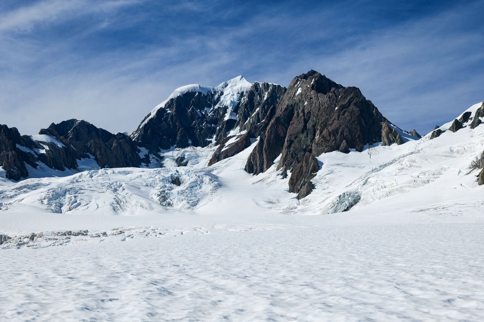
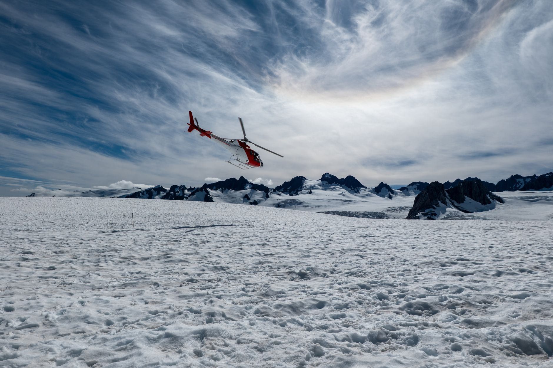
This is the South Side Walkway, also signed as the South Side Walkway/Cycleway, and it's the main DOC track to a glacier viewpoint today. It is not the old Fox Glacier Valley Walk, sometimes called the Terminal Face Walk, which used to lead hikers much closer to the ice from the other side of the valley. That track has been closed since 2019 after flooding damaged the route, and it hasn't reopened — don't go looking for it on the ground. These days the ice itself is off-limits to walkers entirely; the only way to actually stand on the glacier is a guided ice-climbing style trip booked through Fox Glacier helicopter tours.
It's also not the Moraine Walk, a separate 4 km return track (about 1 hr 30 min, easy grade) that loops through older moraine terraces near the same trailhead. Walkers only — no bikes, no wheelchairs. Do both in a morning if your legs can take it; they start from roughly the same spot but tell different parts of the glacier's story.
The glacier's official name is Fox Glacier / Te Moeka o Tuawe. In Ngāi Tahu tradition, Te Moeka o Tuawe translates as the final resting place of Tuawe, an ancestor said to have died here — the same legend links the ice to Franz Josef Glacier down the coast, where his grieving partner's tears are said to have frozen into that glacier instead. For more on the valley's history, see our Fox Glacier visitor guide.
Getting There and Parking
The trailhead car park sits on SH6 about 2 km south of Fox Glacier Weheka township — cross the Fox River Bridge heading south and it's on your left. It's gravel, free, and has no facilities, so fill your water bottle and use the toilets in the village before you set out. There's no public transport out here: a private vehicle is the only way in. For the wider route options if you're coming from further afield, see how to get to Fox Glacier.
| From | Drive Time |
|---|---|
| Franz Josef Village | about 30 minutes |
| Greymouth | about 2 hr 30 min |
| Wānaka | about 3 hr 10 min |
| Queenstown (via Haast Pass) | about 4 hours |
The Walk Step-by-Step
From the car park the track is a wide gravel road, flat and easy, cut through tall podocarp rainforest — rimu and kahikatea draped in moss, tree ferns crowding the edges. Cyclists can ride the whole first stretch; walkers get the same ground underfoot the entire way. After about 40 minutes on foot you reach a clearing with a first glacier view, a good turnaround point if you're short on time or energy.
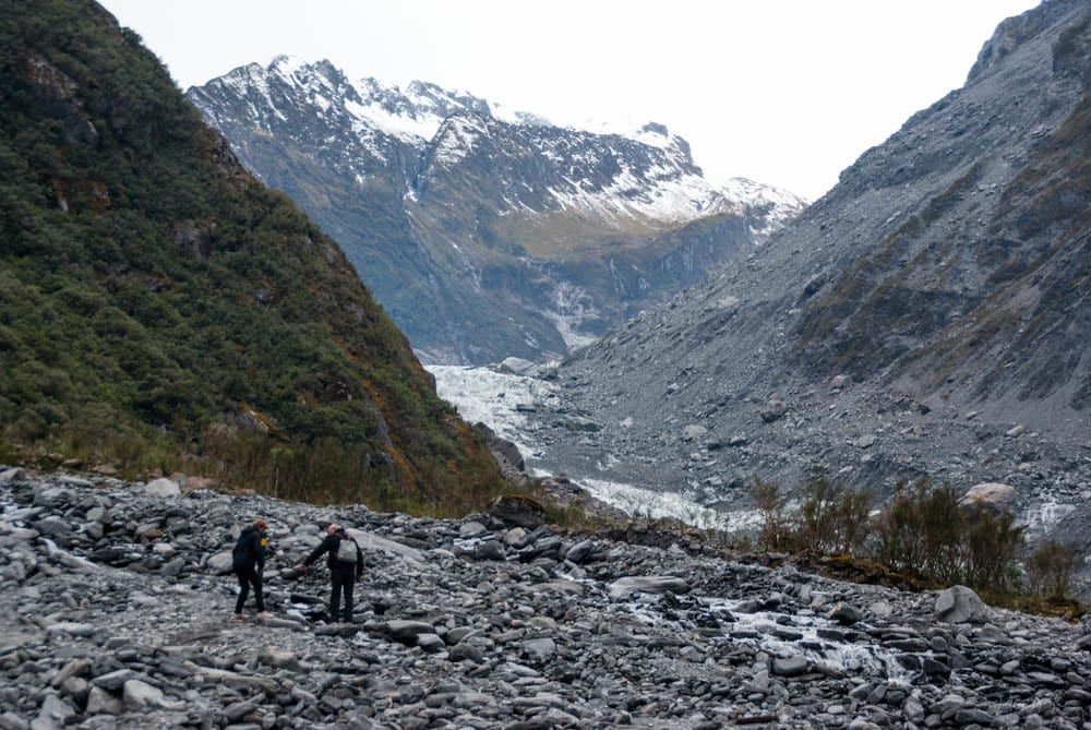
Push on and the gravel road ends at an old car park — this is as far as bikes go. Leave yours here and continue on foot for another 10 minutes or so, the surface changing from packed gravel to loose, rocky moraine as the forest thins out. That last stretch opens onto the moraine flats and the main viewpoint, with the glacier's blue-white face visible across the valley.
You're standing roughly 2,600 m from the terminal face at this point, and that's it. Marked barriers stop foot traffic beyond the viewpoint. It looks like you could keep walking up the valley floor toward the ice. You can't, and you shouldn't try — the ground past the barriers floods and shifts too fast to be safe, which is exactly why the track stops where it does.
Nature Along the Way
The forest changes character as you go, and that's not an accident. Different patches were left bare by the glacier's moraines at different points in its history and have been recolonising ever since, so older, taller stands give way to younger, scrubbier regrowth closer to the ice. You'll cross a handful of glacier-fed streams on solid footbridges or stepping stones, the water running clear and cold even in midsummer.
From December to February southern rātā flowers in patches of deep red along the track, drawing tūī and bellbird in to feed — worth timing your walk for if birdsong matters to you as much as the ice. Deer turn up occasionally near the forest's upper edge, usually at dawn or dusk, though don't count on it.
Safety, Hazards and Track Rules
Alpine weather here changes fast, and a clear morning at the car park can turn to horizontal rain by the time you reach the viewpoint. Pack a waterproof layer and something warm regardless of the forecast, plus sturdy, closed shoes for the uneven moraine near the end.
The real hazard is upstream. Ice dams inside the glacier can burst without warning and send a surge of water and ice down the valley within minutes, which is why the track and its barriers sit where they do. Two tourists died near Fox Glacier's terminal face in January 2009 after crossing safety barriers to get closer to the ice — a blunt reason to treat the marked limits as absolute, not a suggestion.
Dogs aren't allowed anywhere on the track, and neither are drones without a DOC permit — fly one without approval and you risk having it confiscated. Rockfall and flooding can close the track altogether, sometimes for days, so check the daily glacier access update on the Glacier Country website before you drive out. It's a five-minute check that can save you a wasted trip.
Best Time to Walk and What to Pack
The track is walkable every day of the year, but timing changes what you'll actually see. Mornings usually beat afternoons for a clear look at the glacier, since cloud tends to build over the peaks as the day warms up.
December through March gives the best odds of a clear sky and the longest daylight, plus rātā in flower — it's also the busiest stretch, so expect company at the viewpoint. Autumn, March to May, trades some of that reliability for quieter trails and softer light through the forest. Winter can dust the upper glacier with snow, but low cloud can sit over the valley for days at a time and hide the view entirely. A clear winter morning, though, is hard to beat.
- Waterproof, windproof jacket, even if the forecast looks fine
- A warm mid-layer — temperatures swing fast up here
- Sturdy, closed footwear for the moraine section
- Water and snacks — nothing is sold on the track itself
For photos, overcast light suits the rainforest, flattening the deep-green canopy rather than blowing out the highlights. At the viewpoint, a little cloud drifting around the peaks adds drama to the shot — total cloud cover just hides the glacier, so check conditions before committing a whole morning to it.
Pairing the Walk With Other Fox Glacier Highlights
Most visitors treat the South Side Walk as one stop in a fuller Fox Glacier day rather than the whole plan, and two nearby spots round it out well: the shorter Moraine Walk for more forest time, and Lake Matheson for the view the glacier walk doesn't give you.
Moraine Walk
If you've still got energy after the South Side Walk, the Moraine Walk is the natural add-on: 4 km return, about 1 hr 30 min, easy grade, walking only. It threads through older moraine terraces near the same trailhead and shows how fast forest reclaims ground the glacier abandoned decades ago.
Lake Matheson
Lake Matheson is about 6 km, or five minutes' drive, from Fox Glacier township, and it's a different kind of view entirely — still, tannin-dark water reflecting Aoraki/Mount Cook and Mount Tasman rather than the glacier itself. Go at dawn or dusk on a windless day; any breeze ruffles the reflection and the whole point of the walk disappears with it.
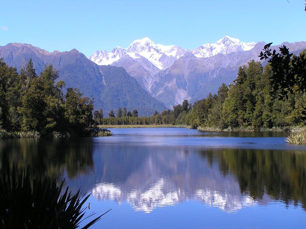
A practical day plan: do the South Side Walk in the morning while the glacier view is clearest, then head to Lake Matheson in the afternoon or save it for a still evening. Base yourself in Fox Glacier Weheka village overnight — it's a small place, and rooms book out fast in summer, so lock in accommodation ahead of time rather than turning up hoping for a room. For more ways to fill a Fox Glacier day, see our guide to things to do in Fox Glacier, or browse Fox Glacier tours if you want to add a scenic flight to the trip.
Frequently Asked Questions
How long is the Fox Glacier South Side Walk?
It's 6.4 km return, taking about 2 hours on foot or 1 hour by bike, according to DOC's official track figures.
Is this the same as the old Fox Glacier Valley walk?
No. The older Valley/Terminal Face walk, which used to get closer to the ice, has been closed since 2019 due to flooding damage. The South Side Walkway is the current route to a glacier viewpoint.
Can you cycle the whole track?
Only partway. Bikes are fine on the gravel road as far as the old car park, roughly the first 40 minutes, but the final stretch to the main viewpoint is on foot only.
How close do you actually get to the glacier?
The main viewpoint sits about 2,600 m from the terminal face. Marked barriers stop foot traffic beyond that point because of extreme flood hazard.
Are dogs allowed on the South Side Walk?
No. Dogs aren't permitted on this track or anywhere else in the Fox Glacier valley.
What is the Moraine Walk and is it different from the South Side Walk?
Yes, it's a separate track — 4 km return, about 1 hr 30 min, walking only, with no bikes or wheelchairs, exploring older moraine surfaces near the same area.
Is the walk suitable for children?
Yes. It's easy grade and mostly flat, formed gravel. The moraine section near the viewpoint is uneven rock but not technical, fine for kids who can manage 6.4 km on foot.
What's the best time of day or year to do the walk?
Mornings tend to give clearer glacier views before cloud builds through the day. December to March has the best odds of clear skies and coincides with rātā flowering, though it's also the busiest period.
Sources
- doc.govt.nz/parks-and-recreation/places-to-go/west-coast/places/westland-tai-pou
- doc.govt.nz/parks-and-recreation/places-to-go/west-coast/places/westland-tai-pou
- doc.govt.nz/parks-and-recreation/places-to-go/west-coast/places/westland-tai-pou
- en.wikipedia.org/wiki/Fox_Glacier
- en.wikipedia.org/wiki/Te_Wahipounamu