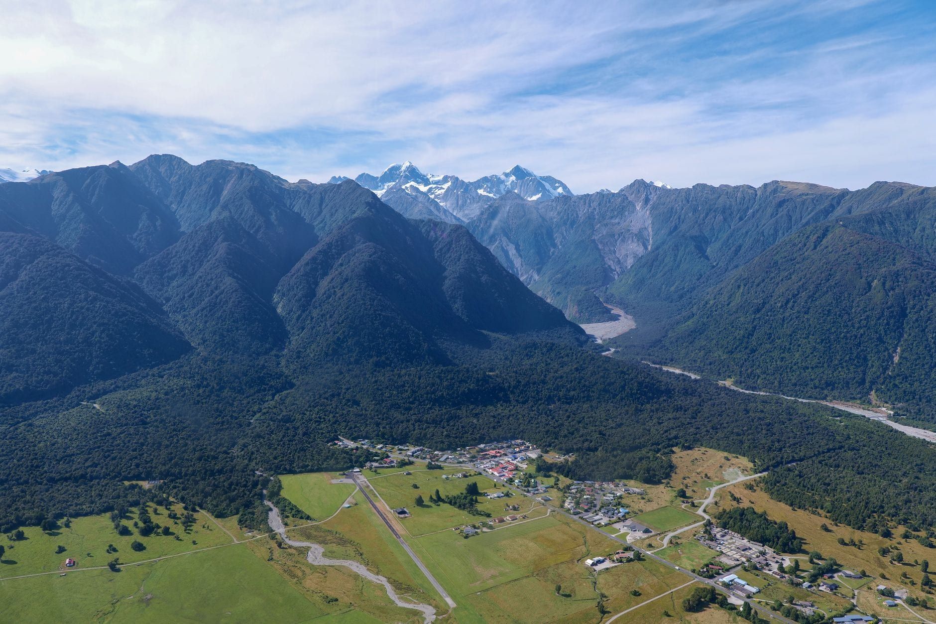
Fox Glacier has walking tracks for every fitness level, from a 20-minute loop to an 8-hour alpine slog, but only two real ways to see the glacier itself on foot: the fenced viewpoints on the South Side Walkway, or a guided heli-hike that lands you on the ice. The old track that once led hikers up the valley to the terminal face is gone, and a surprising number of guides online still haven't caught up.
This guide sorts the eight worthwhile trails around Fox Glacier by distance, difficulty and what you'll actually see, explains why the classic Valley Walk no longer exists, and lays out how a heli-hike differs from a regular walk. For a wider rundown of everything else in the area, see our guide to things to do in Fox Glacier.
Fox Glacier Hikes at a Glance
Six trails cover most of what visitors actually want: an easy walk, a glacier view, or a genuine physical challenge. Distances and times below are DOC's own figures, which resolve a few conflicting numbers still floating around on travel blogs.
| Trail | Distance | Time | Difficulty |
|---|---|---|---|
| Lake Matheson Walk | 4.4 km loop | 1 hr 30 min | Easy |
| Minnehaha Walk | 1.2 km loop | 20 min | Easy, wheelchair/buggy |
| South Side Walkway/Cycleway | 6.4 km return | 2 hrs walk / 1 hr bike | Easy to intermediate |
| Te Weheka Walkway/Cycleway | 5 km return | 1 hr 20 min | Easy to intermediate |
| Mount Fox Route | 7.4 km return | About 8 hrs | Expert |
| Copland Track to Welcome Flat | 18 km one way | About 7 hrs one way | Intermediate, multi-day |
- Families with young kids: Minnehaha Walk or Lake Matheson's Jetty Lookout section.
- Photographers: Lake Matheson at dawn, when the water sits still.
- Short stopover under two hours: South Side Walkway to the first viewpoint.
- Fit trampers after a real workout: Mount Fox Route, weather permitting.
- Extra time and a pack: the Copland Track to Welcome Flat's hot pools.
Why You Can't Walk Right Up to the Glacier Anymore
The Fox Glacier Valley Walk used to run straight up the valley floor to within a few hundred metres of the ice. Not anymore. A 2019 landslide tore out sections of the access road, and further slips and heavy rain since have kept it closed indefinitely. It's the single most common piece of outdated advice still circulating online — several older trail guides describe a walk to the terminal face that simply doesn't exist anymore.
DOC has decided against rebuilding the road. The valley floor is unstable, and the glacier's own retreat means the old route would now dump walkers even further from the ice than it used to. The nearest legal foot access to the glacier is the South Side Walkway, covered in detail below. If a site still tells you to drive up the valley and walk to the face, it's several years out of date.
Easy Walks Near Fox Glacier Village
Three short tracks cover the village side of the valley, none demanding much fitness, and all reachable within a few minutes' drive of Fox Glacier township.
Lake Matheson / Te Ara Kairaumati Walk
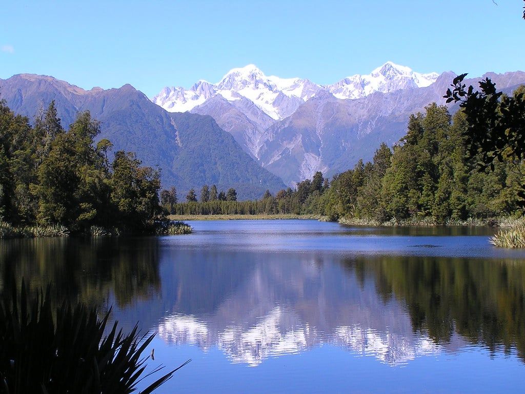
Lake Matheson sits a few minutes' drive from Fox Glacier township, a kettle lake left behind as the glacier retreated centuries ago. The full loop is 4.4 km and takes about 1 hr 30, through podocarp forest to a series of lookouts. The draw is the reflection of Aoraki/Mount Cook and Mount Tasman in the lake's dark, tannin-stained water, best at dawn or dusk when the wind drops — midday breezes usually ruffle it enough to ruin the photo.
Short on time? The stretch to Jetty Lookout is 2.4 km return, about 45 minutes, on a gravel path wide enough for wheelchairs and buggies. The rest of the loop isn't accessible in the same way, so families with a pram or anyone with limited mobility can turn back there without missing much.
Minnehaha Walk
Minnehaha Walk is the shortest option in the area: a 1.2 km loop through rimu and kahikatea forest, done in about 20 minutes. It's flat, gravelled, and open to wheelchairs and buggies, though dogs and bikes aren't allowed. Come back after dark with a torch and you'll likely spot glowworms in the mossy banks along the stream — one of the few spots nearby where you can do that without booking a tour.
Te Weheka Walkway/Cycleway
Te Weheka Walkway/Cycleway runs 5 km return in about 1 hr 20, rated easy to intermediate and shared with cyclists. It won't get you a glacier view. The payoff instead is a lookout over New Zealand's largest active landslide, a visibly shifting slope of exposed rock across the valley. Worth adding on if you're stringing together a few short walks in an afternoon, less essential if the glacier is all you're after.
Best Hikes for Glacier Views
Two linked tracks on the south side of the valley are the only free way left to actually see the glacier's ice from the ground.
Fox Glacier South Side Walkway
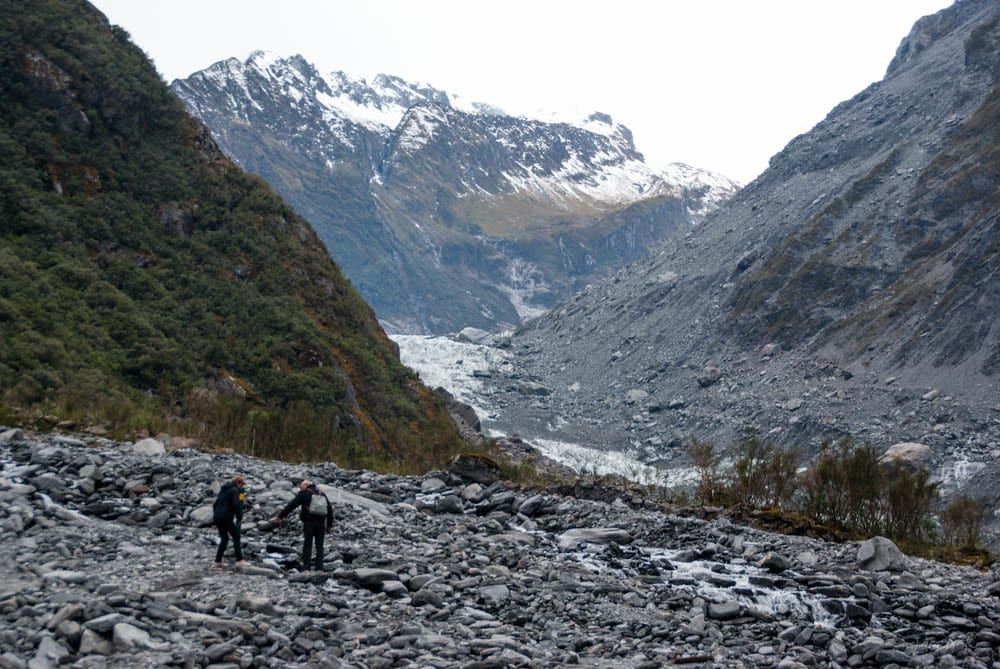
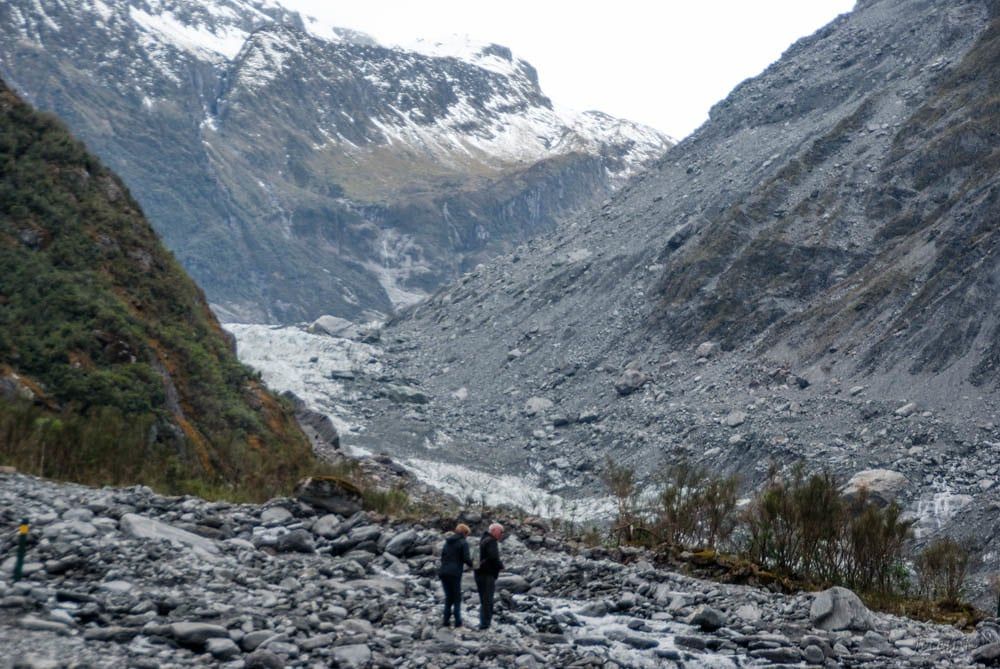
The South Side Walkway is the real answer to seeing the glacier on foot. It follows the Fox River through old-growth rainforest to two fenced viewpoints, the first reached after about 40 minutes and the second ten minutes beyond. The full return trip is 6.4 km and takes about two hours walking, or an hour by bike. DOC rates it easy to intermediate, though the final stretch climbs and drops around 100 m over uneven ground, which rules out wheelchairs and pushchairs. Some older guides still call this the Chalet Lookout Track — that name's retired, and DOC now signs it simply as the South Side Walkway.
Moraine Walk
Moraine Walk is a short spur off the South Side Walkway, about 4 km return and 1.5 hours, crossing the bare rock terraces the glacier left behind as it retreated. It's a good add-on if you want to see how fast rainforest reclaims ground that was under ice within living memory — young trees are already pushing up through gravel that was glacier bed decades ago.
Every viewpoint on these tracks sits well back from the ice, and that's non-negotiable. Two tourists died in January 2009 after crossing barriers near the terminal face when an ice block collapsed. You'll get a clear view of the glacier's face and lower icefall from a distance, not a close approach, and there's no walking onto the ice without a guide — for that, skip ahead to the heli-hike section below.
Mount Fox Route: The Toughest Day Hike
Mount Fox Route is the hardest trail in the area by a wide margin: 7.4 km return, about 8 hours, and rated an Expert route by DOC. It starts at a small parking area at Thirsty Culvert, roughly 3 km south of Fox Glacier township, and climbs a steep, largely unmarked spur through bush to a trig at 1021 m. From there, blue and orange markers guide you up through open grassland to the high point at 1345 m.
The reward is the view: both Fox Glacier and Franz Josef Glacier laid out below, the Southern Alps behind them, and the Tasman Sea beyond the coastal flats. It only works if you beat the cloud there. Afternoon cloud rolls in most days, especially in summer, and DOC warns the route above the bushline is easy to lose once mist sets in. Start at dawn, not mid-morning.
This is a route, not a formed track — no benches, no signage above the bushline, and patchy phone coverage. Carry a map or GPS track, tell someone your plan, and consider a personal locator beacon for the exposed sections. Dogs aren't allowed. If cross-country navigation in poor visibility isn't something you're confident doing, this isn't the trail to learn on.
Beyond the Village: Gillespies Beach, Lake Gault & the Copland Track
With half a day or more to spare, three trails a little further out reward the extra effort with fewer crowds and more variety.
Gillespies Beach
Gillespies Beach is a short drive from Fox Glacier village, with a network of short tracks ranging from a 270 m stroll to a 6.8 km return walk of about 3 hr 30, easy to advanced. The longer routes pass an old gold-mining cemetery and lead to a seal colony on the rocks past the river mouth. Check tide times before walking the open beach itself — the crossing back can flood at high tide.
Lake Gault Track
Lake Gault Track climbs through ancient podocarp forest for about 8 km return, roughly 3 hours, easy to intermediate. It's the quieter alternative to Lake Matheson: the same trick of still water mirroring Aoraki/Mount Cook and Mount Tasman on a calm day, minus the tour buses. Worth it if you've already done Matheson and want the same view without the crowd.
Copland Track to Welcome Flat Hut
Copland Track is the one genuine multi-day hike in the area: 18 km one way, about 7 hours of walking, to reach Welcome Flat Hut. DOC rates it intermediate, an easier tramping track by New Zealand standards, but it's still a full day with a pack on. The reward is a set of natural hot pools beneath Aoraki/Mount Cook, reason enough for trampers happy to carry a night's gear. Book the hut ahead — it fills up in summer — and check river conditions before you leave, since crossings on the way in can rise fast after rain.
Walking on the Ice: Guided Hikes & Heli-Hikes
Nobody walks onto Fox Glacier without a guide, for good reason: the ice hides crevasses, shifts constantly, and calves without warning. Self-guided glacier hiking isn't allowed anywhere on Fox Glacier. The only way onto the ice is a commercial heli-hike, and you don't need a separate permit if you're booking through a licensed operator — that's handled for you.
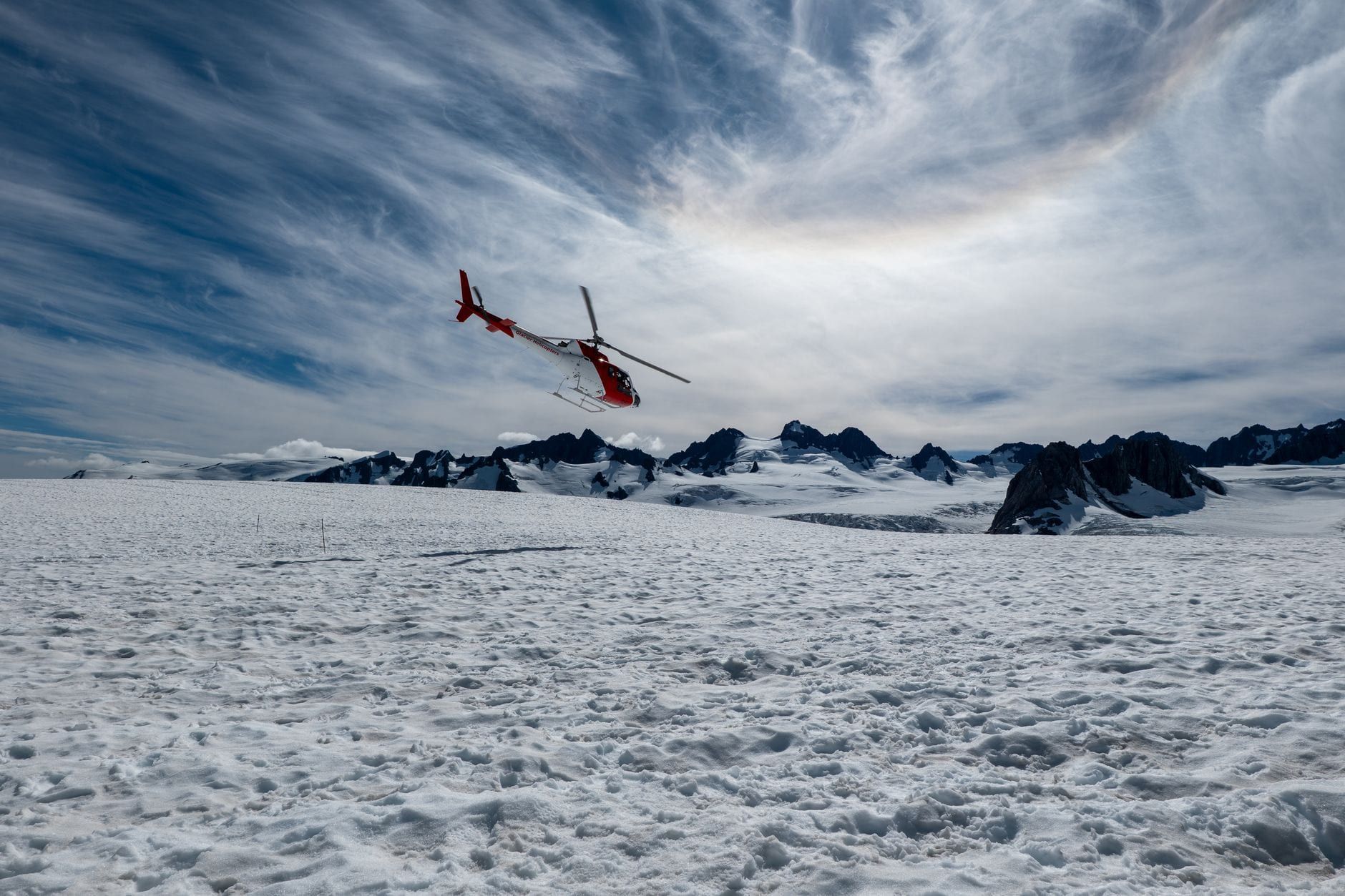
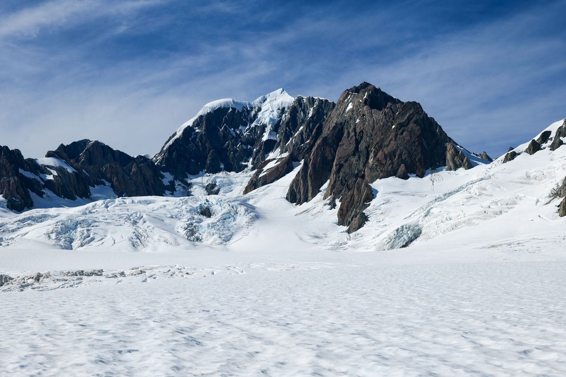
The format is a helicopter flight over the pinnacled lower icefall, landing on a remote section of ice, then two to three hours of guided walking in crampons among crevasses, ice caves and arches that guides cut steps into as conditions shift day to day. Total time door-to-door runs about four hours. Crampons, boots, waterproofs and a helmet are provided; bring your own warm layers and gloves. Skip the jeans — they don't dry and don't insulate once wet.
Weather calls the shots. Flights get rescheduled often enough that booking your glacier heli-hike tour for the first full day of your trip, rather than the last, buys you a backup date if cloud or wind cancels the morning flight. Compare current departure times and options on our tours page before you book. Franz Josef, about 25 minutes north, runs a near-identical heli-hike if Fox Glacier's flights are grounded or sold out — worth checking rather than losing the day.
Planning Your Hike: Best Time, Weather & What to Pack
December to February is summer on the West Coast: 15-25°C, long daylight, and the most stable weather of the year, which also makes it the busiest season and the easiest for heli-hike scheduling. Autumn (March-May) runs a close second, with settled weather and thinner crowds. Winter (June-August) brings short days and a higher chance of storms closing roads and tracks, but clearer air on the days you can still get out. Spring (September-November) is the wettest stretch, with the highest odds of flooded tracks and cancelled flights.
Afternoon cloud is a daily pattern here, not bad luck — moist sea air hits the Southern Alps and builds cloud through the day. That's why Mount Fox climbers start at dawn, and why the clearest glacier photos from the South Side viewpoints tend to come before mid-morning.
- Waterproof jacket and warm layers — weather flips fast in this valley.
- Sturdy, broken-in walking shoes or boots.
- Insect repellent — sandflies are vicious around Lake Matheson.
- Offline map or GPS track, especially for Mount Fox.
- Extra water; taps are scarce once you're on the trail.
Check the glacier area's daily access update before you set out, since rockfall, flooding and storm damage close tracks with little notice, and leave your intentions with someone before tackling Mount Fox or the Copland Track. Confirm current track and visitor-centre hours on our hours and fees page, and check the directions page for routes into the village and the various trailheads. For background on the glacier's history and the wider area, see our about page.
Frequently asked questions
Can you still hike to the Fox Glacier terminal face?
No. The old Fox Glacier Valley Walk has been closed indefinitely since a 2019 landslide damaged the access road, and DOC has decided not to rebuild it. The closest legal foot access now is the viewpoints on the South Side Walkway.
What is the easiest walk near Fox Glacier?
Minnehaha Walk is the shortest and easiest, a 1.2 km loop taking about 20 minutes and open to wheelchairs and buggies. Lake Matheson (4.4 km loop, about 1.5 hours) is the most scenic easy option.
How hard is the Mount Fox hike?
Very hard. It's 7.4 km return, about 8 hours, and rated an Expert route by DOC, with a steep, largely unmarked climb above the bushline to 1345 m. It's for experienced, well-equipped trampers who start at dawn to beat the afternoon cloud.
Can you walk on Fox Glacier by yourself?
No. Independent ice access isn't permitted anywhere on the glacier because of hidden crevasses and constantly shifting terrain. The only way onto the ice is a guided heli-hike, combining a helicopter flight with two to three hours of guided walking on the glacier.
How long does it take to see Fox Glacier on foot?
The short version, South Side Walkway to the first viewpoint, takes about 40 minutes each way. The full South Side Walkway/Cycleway return trip is about 2 hours over 6.4 km.
What is the best time of year to hike at Fox Glacier?
December to February has the longest days and most stable weather (15-25°C) but is the busiest season. Winter (June-August) has clearer air and fewer crowds, though shorter days and more weather-related cancellations for heli-hikes.
Is Lake Matheson part of Fox Glacier?
It's a separate short walk a few minutes' drive from Fox Glacier township, known for still-water reflections of Aoraki/Mount Cook and Mount Tasman rather than a direct view of the glacier itself.
Do you need a permit to hike near Fox Glacier?
No permit is needed for the independent tracks, including Lake Matheson, Minnehaha, the South Side Walkway and Mount Fox. Guided glacier heli-hikes just require booking with a licensed operator.
Sources
- doc.govt.nz/parks-and-recreation/places-to-go/west-coast/places/westland-tai-pou
- doc.govt.nz/parks-and-recreation/places-to-go/west-coast/places/westland-tai-pou
- doc.govt.nz/parks-and-recreation/places-to-go/west-coast/places/westland-tai-pou
- doc.govt.nz/parks-and-recreation/places-to-go/west-coast/places/westland-tai-pou
- doc.govt.nz/parks-and-recreation/places-to-go/west-coast/places/westland-tai-pou
- glaciercountry.co.nz/things-to-do/unguided-walks-and-hikes
- en.wikipedia.org/wiki/Fox_Glacier